Icons of some innovations. For a list of 16 items click here
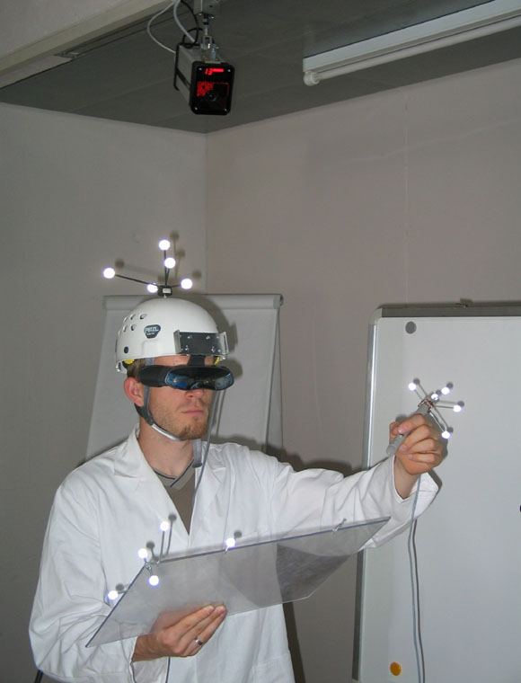
Augmented Reality Environment
with Tracked Person and Devices: Helmet, Pen, Tablet,
2008 |
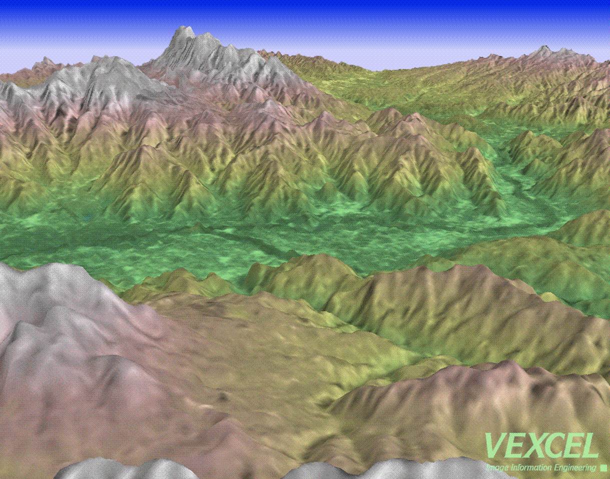
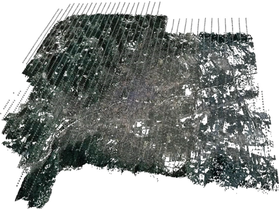 Increased Redundancy Photogrammetry
3000 Digital Aerial Photos Covering
Graz [150 km2]
2009 |
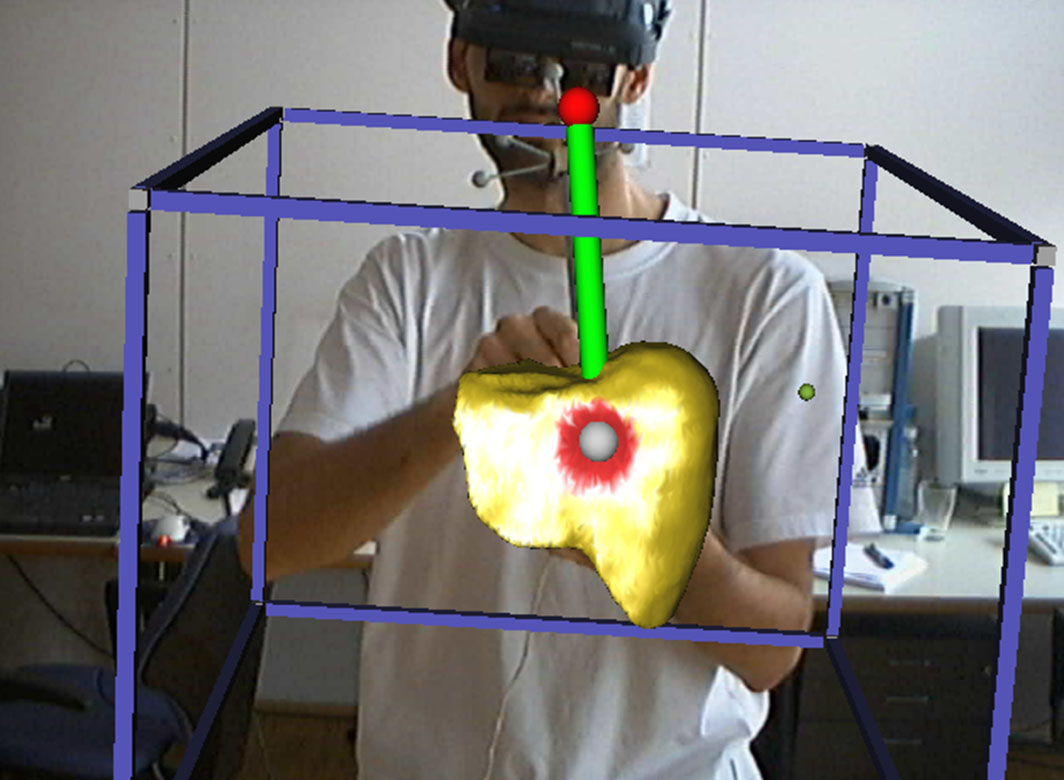 Virtual Liver Operations Planning Tool: Segmented Liver and Tumor in 3D,
Virtual Scalpel
2007 |
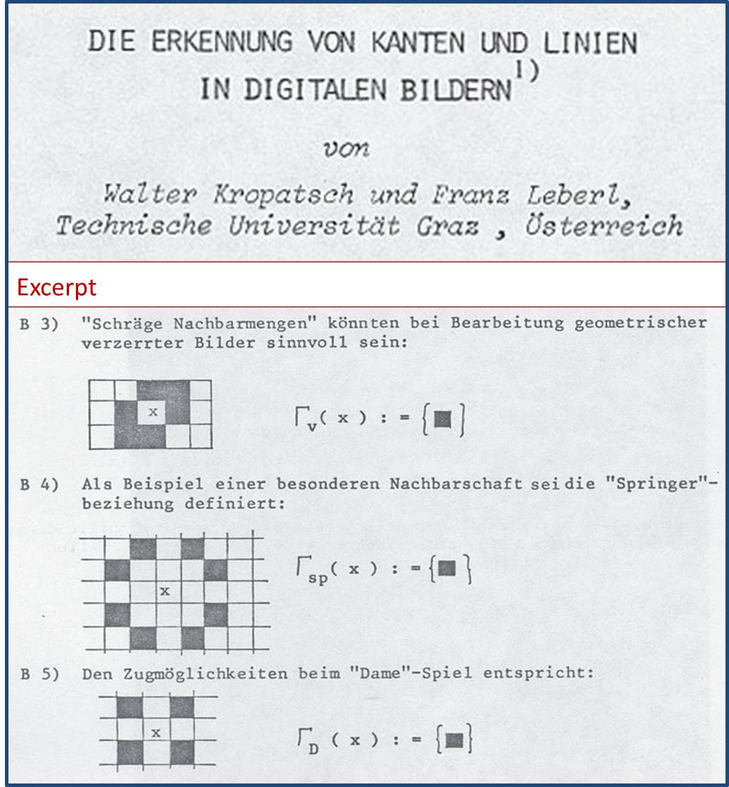
Pattern Recognition Paper 1978 |

3D Buildings @ Vancouver to Plan Wireless LMDS Transmission Network, Colors for Improved Interpretability |
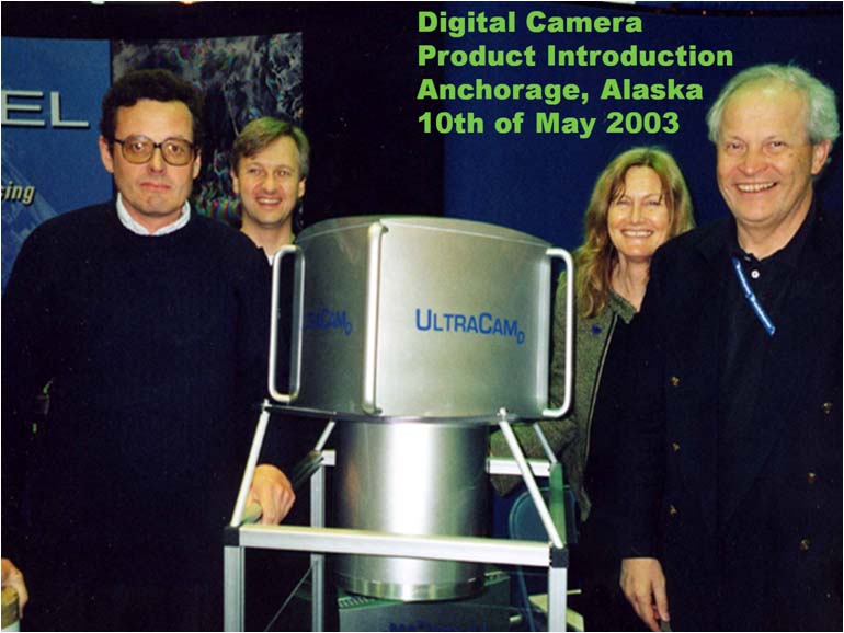
UltraCam-D Large Format Digital Aerial Camera at ASPRS Convention. M. Gruber, W. Walcher, T. & F. Leberl |
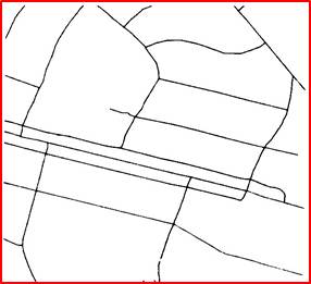
Map Generalization for Scale Transition with Raster-Scanned Paper Map of Roads, Vectorized |
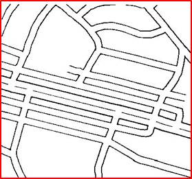
Map Generalization with |
 UltraScan 5000 Precision Scanner for Aerial Color Film @ Accuracy at ± 1 µm, with Automated Roll Film Management UltraScan 5000 Precision Scanner for Aerial Color Film @ Accuracy at ± 1 µm, with Automated Roll Film Management1999 |
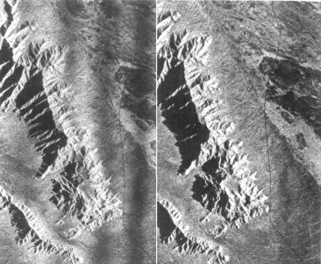 Aerial Stereo Radar Image Pair Aerial Stereo Radar Image PairCommercial System by Goodyear System, Arizona 1972 |
Satellite Radarsat Stereo-Based |
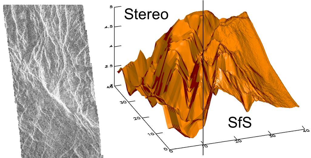
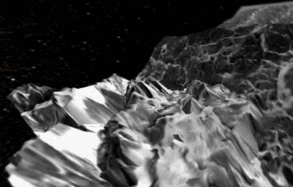
NASA Magellan Elevation Model of Venus-Surface by Radar Stereo and Shape-from-Shading, |
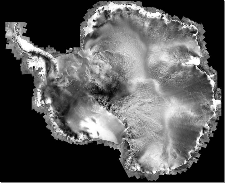
Satellite Radar Strips Merged into Mosaic of Antarctica, Created by Vexcel Corp. in Project RAMS for Ohio State University / NASA |
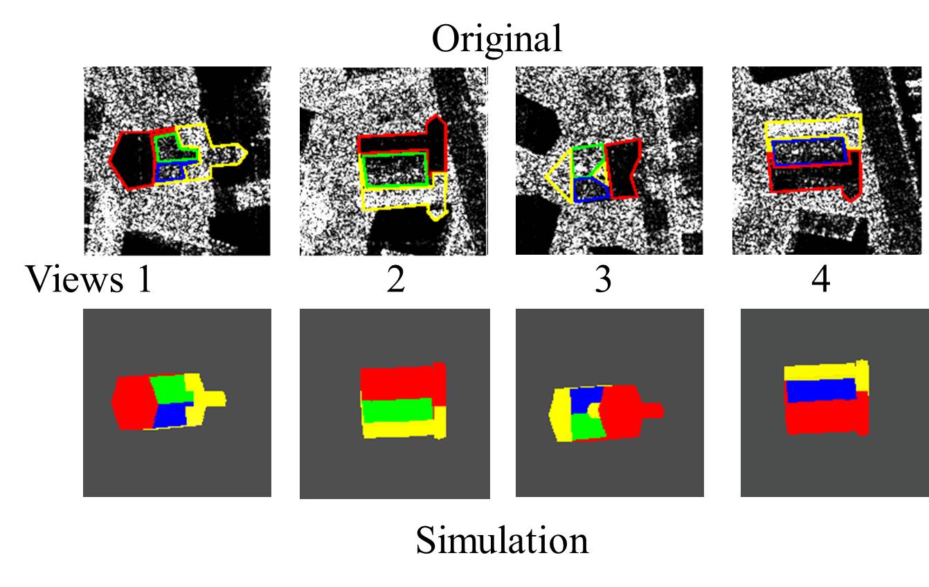
Aerial SAR, 25 cm Interpretation of 4 Real SAR-Images of a Church by Simulation |
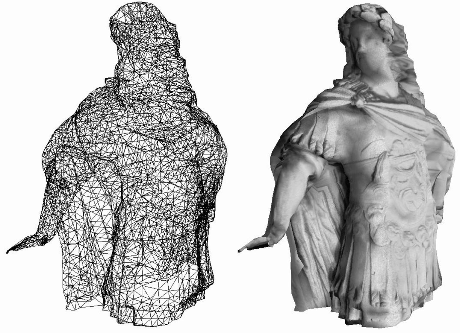
3D Surface Habsburg Emperor Karl IV |
Raster Electron Microscope 3D Model of Broken Metal Surface, Micrometer Detail [PhD Project Stefan Scherer, ~ 1999] |
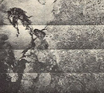
Aerial Arctic Sea Ice Radar Image Strips Merged into Mosaic for AIDJEX Project and JPL-NASA |
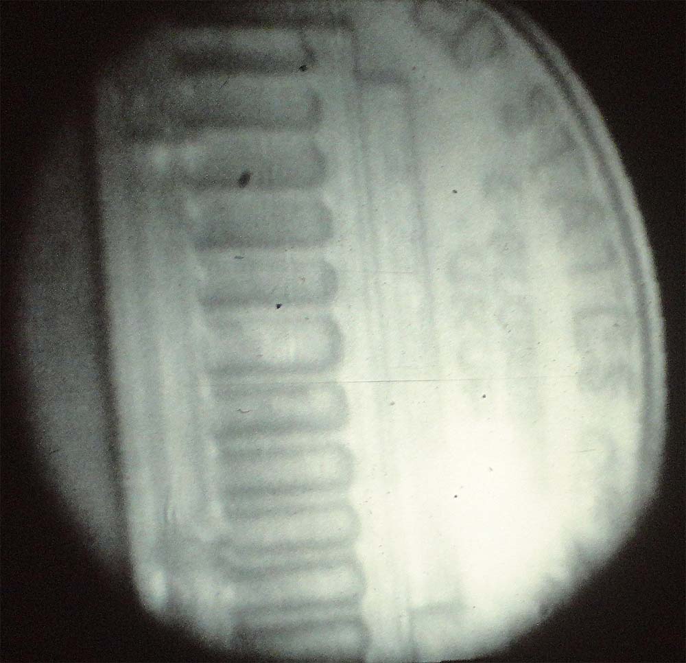
Endoscopic Imaging for Medical Surgery, Tested Using a US Coin 1982 |